
Tornadoes In February? Yes They Do Happen
Sign up for the Morning Brief email newsletter to get weekday updates from Weather Now 24 and our meteorologists.
A tornado touched down in South Dakota Monday afternoon,the state's first February and winter twister on record in at least 75 years.
The brief tornado: The short-lived tornado was documented by Severe Studios storm chaser Alex Resel just after 4 p.m. CST in Coddington County,South Dakota,about 85 miles north of Sioux Falls.
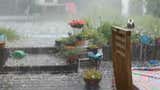
While it didn't take on the classic appearance of a tornado with a distinct cone-shaped condensation funnel,you can see whirls of dust as the circulation made contact with the ground.
It was rated EFU by the National Weather Service (NWS) and only lasted a minute over open country about 10 miles southeast of Watertown near Interstate 29.
The EFU rating for "unknown"is used by the NWS in situations when there is evidence a tornado existed,but no damage occurred.
Why it's historic: If this was,say,a mid-summer tornado over open country in the Northern Plains,it may not have captured much interest besides the video.
But this was South Dakota's first February tornado in reliable records from NOAA dating to 1950.
Even more stunning,of 1,918 documented South Dakota tornadoes over the past 75 years,none previously occurred in winter,or from November through February.
(For even more granular weather data tracking in your area,view your 15-minute details forecast in our Premium Pro experience.)

How it happened:Most severe thunderstorms that spawn tornadoes need a combination of changing winds with height known as wind shear,as well as a significant difference in temperature and humidity with height,called instability. That temperature difference is usually warm,humid air near the ground topped by cold,dry air aloft.
It's hard to get warm,humid air that far north in February. Watertown,South Dakota only reached a high of 50 degrees Monday,hardly the type of warm,humid day you'd associate with severe thunderstorms.
But what Monday lacked in heat it more than made up with atmospheric spin.
"We did have a lot of shear near and just above the ground,"wrote Steven Fleegel,science and operations officer at the National Weather Service in Aberdeen,South Dakota,which serves the area.
"The combination of that,with the front moving through,increased the surface circulation in that area. So those were able to combine with the little bit of instability we had to produce a rotating storm and the tornado,"said Fleegel.
(Further beef up your forecast with our detailed,hour-by-hour breakdown for the next 8 days – only available on our Premium Pro experience.)
Bitter cold just a week ago:If you've been following the weather recently,you may remember the Plains was among the areas shivering most in an arctic cold outbreak that smashed hundreds of daily temperature records from the Dakotas and Montana to the Gulf Coast.
But as the weather pattern changed and arctic air retreated,we witnessed a typically dramatic warm-up by Plains standards.
For example,Mobridge,in north-central South Dakota,rose from a low of minus 30 degrees on February 18 to a daily record high of 63 degrees five days later.
Another first for February one year ago: This is the second consecutive year we've seen a state record its first February tornado.
In early February 2024,a pair of tornadoes tore through parts of southern Wisconsin,the Badger State's first February tornadoes in records dating to before statehood. One of the tornadoes was strong (rated EF2) and was on the ground for 26 miles.
And in 2016,rare February tornadoes tore through parts of Pennsylvania.
Given the typically expansive cold air across the country,February is usually among the least active months for tornadoes in the U.S.
While February has had its outbreaks,usually,the tornado threat during the month is pinned to the southern U.S.,where warm and humid air is more easily tapped.
However what happened Monday is just another example illustrating that tornadoes have developed,and will again develop,when conditions are favorable,regardless of time of year.

Jonathan Erdman is a senior meteorologist at www.weathernow24.com and has been covering national and international weather since 1996. Extreme and bizarre weather are his favorite topics. Reach out to him on X (formerly Twitter),Threads,Facebook and Bluesky.